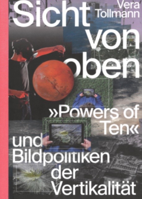
 In Sicht von oben, ‘Powers of Ten’ und Bildpolitiken der Vertikalität (Spector Books, Leipzig, 2022) German media theorist and curator Vera Tollmann analyses the power aspects of the technical view from above. The context here is not so much the first manned flight with a balloon in 1783 in Paris but the iconic 1968/77 short film Powers of Ten by Charles and Ray Eames, which can be considered the first virtual camera trip. Her study can be seen as material image analysis along the lines of Friedrich Kittler’s optical media and is strongly informed by the work of Hito Steyerl. Part one deals with the verticality of the image regime, while part two focuses on the vertical aspect and part three theorizes scale and scalability.
View from Above opens with a detailed analysis of the historical Powers of Ten in which Tollmann distinguishes between four image cultures: cartography-related images from above, satellite images, taken from space, telescopic images, taken in the context of astronomy and back to the smallest units, microscopic images, used in biology and medical research. These were all taken in the analogic age of photography so the question comes up immediately how this image regime functions in the digital age. Throughout the work, Vera Tollmann draws on artworks and visual culture analyses such as Judith Hopf’s sculptures, Hito Steyerl’s ExtraSpaceCraft, Gabrielle Hecht’s ‘interscalar vehicle’ and Matt Mullican’s Planetarium in which he posits space travel as inner experience. Similarly rich are here theoretical dealings from Bruno Latour’s anti-zoom position, Hannah Ahrendt’s response to the launch of Sputnik in 1957 to multiple space aspects in the oeuvre of Donna Haraway.
An example of the epistemological shift could be the hegemonic point of view of this era: the drone. Think of the war in Ukraine in which the ‘flying camera’ looks down at its target. The mass-manufactured drones is a proof of Tollmann’s deadly image politics from above.
Since 2021 Vera Tollmann has been a guest researcher at the Institute for Culture and Aesthetics of Digital Media (ICAM) at Leuphana University in Lüneburg. The study, written in German, is a very interesting read, raising so many questions, so we decided to conduct an email interview, in English, so that also non-German speakers can get an idea about its content and Vera’s background ideas. Vera Tollmann’s work is known for those familiar with the Berlin festival Transmediale and the Institute of Network Cultures’ VideoVortex network on the politics and aesthetics of online video.
Geert Lovink: Your study is about ‘image politics of verticality’ and centres around the ‘Powers of Ten’, a short film by the Eames couple, produced in 1968/1977, in which the viewer moves into deep space and then goes back into the opposite direction, to the core of molecules and DNA. How did you stumble into this topic? Could you give us a brief media archeology of the view from above? It is not a study about the history of the telescope and the microscope, I noticed. What’s, historically and aesthetically, the difference between looking up and looking down? In the book we seem to go down a lot, not up. Is this based on the familiar power difference, from those, on top of the hill, looking down on the plebs in the village, the superior God perspective in contrast to the star gazing of the ordinary people in the fields?
Vera Tollmann: It was a coincidence! In the summer of 2014, I was in the Mongolian steppe as a curator with a group of 20 artists, and the idea was to rethink Land Art, for example, not for the ‘view from above’, as Smithson did in Utah at the shore of a salt lake in 1970. Claire Pentecost proposed the perspective of the snout. While writing a short text for the presentation in Ulaanbaatar, the Eames film came to mind. The cultural critic Brian Holmes suggested that I should save the film for later on, a future project. When I returned to Berlin and read a call for applications for the graduate program “Aesthetics of the Virtual” at the Hochschule für bildende Künste Hamburg, I decided to submit a PhD project proposal based on the film.
In the second chapter of my book I touch on media archaeological aspects, but media history is actually traced through preserved images like the famous aerial photographs by Nadar or Edward Steichen, and those lesser known by Cecil Victor Shadbolt.
John Glenn’s 1962 historical orbital flight, featured in Tom Wolfe’s The Right Stuff book (1979) and Philip Kaufman’s film (1983).
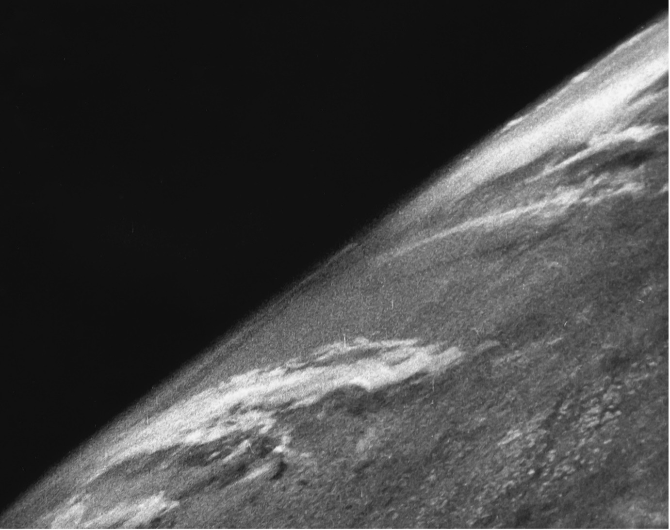
One of the first photos from out of space, dated October 24, 1946, was taken from the sub-orbital U.S.-launched V-2 rocket (flight #13), White Sands Missile Range. Pictures were taken every one and a half seconds.
The history of aerial images began with daring balloon flights, stabilized a little with the first aeroplanes, took off again into orbit with unmanned rocket experiments, and with satellites reached an image quality that interested not only the military but also research institutions. As a result of paradigm shifts, these aerial images have an impact on subjectivity, knowledge and power: In the beginning, it was the subjective fascination of the new overview that triggered the ascent, then the rationale of using the images as a basis for maps or for spying on enemies, as an instrument for measurement.
At first glance, historical and aesthetic distinctions between representations of the view from above and the view from below upwards into the sky cannot, of course, escape a traditional understanding of power. On the other hand, the philosopher Christine Buci-Glucksmann,[1] for example, discussed maps as a substitute for flight, supporting a ‘liberation’ of bodies, as well as a model of seeing knowledge (voir savoir). She is interested in dispositives altering the traditional perceptions of the world for the human observer, such as Buckminster Fuller’s and Shoji Sadao’s 1954 map “Dymaxion Airocean World”, which opposed the standard Mercator projection.
 Geert, you seem to be describing painted representations featuring an elevated viewpoint, still within the human range of perceiving the world, which incidentally tells of feudal power relations, right? This hierarchical organization of verticality and the question of access to the view from above has clearly faltered in our century. Applications such as Google Earth and Maps, NASA’s uploading of images and videos (even though very low resolution), and even videos recorded with consumer drones that can be flown at altitudes of up to 120 metres contribute to the availability of aerial vision. Meanwhile, aerial warfare is becoming even more abstract, ‘invisual’.[2] The latest entry to the arsenal of aerial warfare are prototypes of AI drones developed in the Collaborative Combat Aircraft (CCA) program of the US Air Force One of the models is actually called Valkyrie after a successful (or popular) bomber. The drone’s data stream is probably beyond Buci-Glucksmann’s Icarian gaze in aerial photography and representing technological perception.
GL: Why is the difference between dreaming and imagination versus the power politics of control so crucial? Is there a certain German scepsis at play here against images and imagination, especially those produced by ’techno-science’? From the very beginning, you talk about power and the ‘viewing regime’ of seeing. Is the image of planet Earth in itself a dominant one, aimed to suppress minority interests, and other voices? While it’s obvious that for 50-70 years NASA and the Soviets were both military imperial powers and the images of space were all over-coded by Cold War rhetoric, produced in the interest of the military-industrial complex, is this still the case today? On page 240 you ask the central question, with Arendt: have the space endeavours made man larger or smaller? I would say that people have other worries and fascinations these days. It’s not 1969 anymore. The space race was over a few years later and is now business as usual. What type of criticism would go with that normalized attitude?
VT: Arendt’s essay is a critique of modern science and its non-anthropomorphic, non-humanistic, non-geocentric view of the world, divorced from human sensory perception: “for we meet them nowhere, neither in our everyday world nor in the laboratory; we know of their presence only because they affect our measuring instruments in certain ways”. Even then, Arendt questioned scientists’ belief that computers would surpass the human brain as an “alarming proposition” because they did not distinguish between brain and mind. Together with Max Planck, she argued for translations between the physical world and the sensory world, which are now commonplace in social media. I think that Arendt’s answer to the question “Has man’s conquest of space increased or diminished his stature?”,[3] posed at the 1963 Symposium on Space, sixty years ago, is still valid, although it no longer evokes the same fears and fascinations as it did in the atomic age. Today, her commentary can be read in the context of the manned spacecraft currently being planned by the Indian, Chinese, Russian or US space agencies. Other time scales are involved here: ice water on the Moon that is more than four billion years old will be tested to see if it can be used as a resource for space travel beyond the Moon.
As the model’s name Valkyrie suggests, the Air Force is fantasizing, too. As did the National Reconnaissance Office (NRO) with its spy programme Sentient launched in 2019 and not heard of since. Sentient was designed to interconnect and algorithmically analyse in real-time all long- and short-range intelligence technologies and associated databases, according to US intelligence, mobile devices, social networks, commercial and military satellites, appropriately equipped ships and aircraft and environmental sensors. The example illustrated two points in particular: the ambition to increasingly interconnect existing systems and databases, and the lot of patchiness. A mode of dreaming or envisioning in combination with political imagination is addressed in my book, for example, Hito Steyerl’s video “ExtraSpacecraft” is about the launch of a virtual space agency, emerging from the ruins of an observatory in Iraq.
Elsewhere I refer to cosmograms and cosmotechnology as theorized by John Tresch as partial configurations of the world-turned image. In a way, Tresch is a historically and aesthetically informed historian of science equipped with imaginative power. He knows the archives and reads people’s worldviews and projections from old objects such as maps, artworks and their related contexts. After all, the Eames are also very dreamy, but at the same time, they have a powerful professional network that spans from US government agencies to global companies and scientific institutions, which are all involved in processes of world-building. It is true that I read the images primarily for their power effects, writing about the ‘viewing regime’ of seeing. This has to do with the fact that Western conventions of representation were established early on, with a few exceptions, such as the members of the crew of the first Apollo moon landing expressing their fascination for the Earth on TV in “Face the Nation” with CBS News, admiring its boundlessness and beauty. Seeing the Earth has made them feel the need to protect the planet.

This image of the Sgr A* black hole in the Milky Way is an average of the different images the EHT Collaboration extracted from its 2017 observations. Credit: EHT Collaboration
I agree with you that the over-coded and over-controlled images of the Cold War era no longer cover the world we live in today. Today we are dealing with different kinds of images that are overproduced in their own way. Take for example the image of a black hole that was released in 2019. That was a fascinating virtual image, it wasn’t actually “taken“ from Earth, but calculated here on Earth. Still, this image could have an impact similar to the famous “Blue Marble” photo that turned the relationship between humans, earth and space on its head in the late 1960s. Orit Halpern and Robert Mitchell call the black hole image “an image of smartness”. It was created by virtually combining telescopes at different locations around the world to form a giant planetary telescope. According to Halpern and Mitchell, the planet in this case was designed as “a data-gathering machine”. Bernard Geoghegan has recently described this level of scale and processing as a “geo-scopic drive”.[4] So we are looking into deep space in the same way as we are looking back at Earth with the numerous satellite images that are also analyzed for civilian forensic reconnaissance by groups such as Forensic Architecture, among others, during the Ukraine war; as long as the images are not affected by shutter control or embargos. Newer sensor networks hold the epistemic promise of being able to observe and measure physical phenomena at higher spatiotemporal resolution.
The recent landing of the Indian spacecraft on the moon’s south pole, the “dark side of the moon”, could signal an interesting shift away from Western conventions. The Chandrayaan-3 mission of the Indian Space Research Organisation (ISRO) is sending entirely new videos back to Earth. The space agency’s logo looks appealing, constructivist: a red abstracted antenna (or mast) is crossed by a blue dotted line, suggesting an active data link. Supposedly the rear wheels of the Pragyan rover were designed to leave imprints of the Indian Space Agency logo and the Indian national emblem. I could not see this in the video clips, although I cannot judge how long these marks would last on the moon’s surface. After all, it does not exactly feel like “a new race to the moon”, as the New York Times put it. A video shot with Vikram Lander’s camera has been released at an accelerated pace, meeting with current habits of speed-watching digital video. There’s no time to watch in real time or maybe the event is just not as exciting as it was in the first space age with manned Mercury and Apollo missions.
GL: In View from Above the ‘crisis of scales’ is playing an important role. Can you explain this to us in the light of the current climate crisis? Is the planetary perspective something we should be wary of? Are local, regional or geo-political levels better scales? What implications do you see of the theories for the work artists and activists are doing in this field?
VT: Gyorgy Kepes, a contemporary of the Eames, described the experience of having to communicate new, previously unknown scales as a ‘crisis of scale’ twice in his designer career – in the early years of the space age[5] and in the early 1970s with the beginning of the ecological crisis[6] (or rather the first realizations that pollution caused by humans could make our planet uninhabitable, even for ourselves). In terms of the climate crisis, we are also dealing with collapsing scales or distances. It was an expression of Kepes’ excessive demands as an artist and designer to respond to the new imaging processes of the time. Art can establish new relations between known and as-yet-unknown phenomena, the visible and the invisible (but rendered visible with technological instruments). Artists and activists stress the importance of maintaining the human scale and with it human perspective and agency. Action and activism need the local scale – as the slogan “think globally, act locally” sums it up. For example, litter pickers collect rubbish locally in rivers, streets and parks to prevent battery fluids from seeping into groundwater or plastic from floating into the oceans. Actors are networked regionally and internationally to gain visibility, helpers, supporters and motivation. Theories provide statements and arguments that help activists make a political difference, such as persuading governments to introduce new laws. Neither local, regional or geo-political levels are per se better scales, but depending on the topic or problem that is meant to be pictured or grasped, all scales need to be taken into account, which is quite challenging.
In 2022 Joshua DiCaglio published Scale Theory in which he explores the meaning of scale and proposes the term “metre scale” to make clear that we humans tend to express “non-human” scales by comparing them to our familiar system of measurement, just as the Eames do in “Powers of Ten”. DiCaglio thinks about scaling as an expression of power and the difficulties one can have in conceptualising the ways in which scalar objects, subjects and relations interact at different levels. According to DiCaglio, scale reconfigures what we observe: What appears on one scale becomes invisible on another scale, which may be larger or smaller and vice versa. The difference in resolution between these scales is marked by what DiCaglio calls thresholds of observation (with one instrument or the other).
GL: The theorists you’re using such as Arendt, Haraway and Holert seem to keep a distance of the verticality technologies. From an activist and social movement’s perspective, this is somewhat surprising in this age of climate crisis and the war on climate data, which is going on, in which visualization of data and the earth play a key role. There is also a real fight happening on an economic level who’s got access over which satellites for what purpose, which is no longer merely the military-industrial complex but also Elon Musk and his SpaceX and his Starlink network of thousands of communication satellites.
VT: I agree. The political issues surrounding satellites have become more complex. In a recent piece on Musk for The New Yorker, Ronan Farrow spoke of “Elon Musk’s Shadow Rule”. Musk can set the standards for electric car charging stations and spread fake news on his own social media platform X (formerly known as Twitter), and as recently as June 2023, the US Department of Defense had to strike an agreement with Musk for Starlink service in Ukraine, as Musk was demanding some kind of payment for the military use of Starling satellites in Ukraine. The content of this agreement is unknown. This is certainly a shift in power, with the industrial arm of the private ‘military-industrial complex’ gaining power over the US military. The question about which countries own satellites, which satellites’ data is available outside the military, and who is able to analyze the data (not just the ‘minimal data’, as Laura Kurgan critically called the compressed data sets largely stripped of metadata) remains to be investigated (cf. Lev Manovich on ‘data classes’ in a ‘big data society’ in relation to social media). I originally wanted to end the book with a commentary on Starlink. However, the editor advised against it because it was uncertain how the situation in Ukraine would develop. Military experts argue that the war in Ukraine is the first commercial space war and a test case for the future of war, the hyper war in which machines could only fight each other.
Much is happening in the research field of perception enhanced and augmented by AI. However, whether these systems will ever be stable, trustworthy and accepted by their users remains to be seen. For the time being, soldiers in the US Army have rejected AR glasses developed by Microsoft to augment vision with layers of drone feeds from above, infrared cameras in the field and maps, among other data sources. Soldiers testing the headsets have complained about their “mission-affecting physical impairments”.[7] Putin’s war of aggression in Ukraine shows that such technologies are far from having arrived on the battlefield. High-tech requires an infrastructure often attacked in wars. As Svitlana Matviyenko recounted in her lecture “Terror Environments: Writing through War” at Leuphana University in May this year, the war arrived infrastructurally, with the heating and internet connection being the first to go. Elon Musk updated the Starlink software in March 2022 to reduce the power consumption of the devices. Ukrainian defence forces, to whom Musk delivered truckloads of Starlink equipment after the start of the Russian war of aggression, can now use a car cigarette lighter to power their internet reception if necessary. As we now know from Ronan Farrow’s investigation, many were distracted by the acute situation and military need and failed to question what it would mean for a single company like Starlink to provide such a central infrastructure in the long term.
GL: Bruno Latour is playing a particular role in all this. Can you explain his anti-zoom argument as I don’t get it. In the last years of his life he became involved in the climate change issue, and not just via Gaia thesis work. What was his take on climate data visualisations?
VT: Over the course of several decades, books and exhibitions at ZKM, Bruno Latour mentally pushed away from Eameses‘ short film and developed his approach to ecological thinking. In the classical imagination, “nature“ is represented in levels and layers; it was possible to pass from one to another, to pass according to a continuous, orderly process of “zooming”. The film creates a vision of smooth scaling without addressing what remains invisible, and this is what most upset Latour. From his academic perspective, Latour was more interested in lived connections and networks instead of abstract mathematical models and smooth continuity from galaxies to particles. In a way, NASA nowadays organizes its datasets according to the same principles: flow, knowledge and models, among others.
Bruno Latour used the short film several times to reject modernism and its scientific parameters. For him, the film was the epitome of a misguided representation because he was concerned with activity and agency, the actor-networks, not the spectrum of the viewing machine. On several occasions, he delivered his critique polemically. When towards the end of his life he teamed up with a landscape architect and a geochemist he finally managed to move from criticism on “Powers of Ten” to proposing alternative modes of visualization, he came to terms with the film and advocated in favor of powerful three-dimensional data visualisations that he and his collaborators called Gaia-graphy, following Lovelock and Margulis’ Gaia hypothesis.
I first encountered examples of Gaia-graphy at the Critical Zone conference in Hamburg at the Warburg-Haus in 2019, and felt my trained idea of what a visualisation of Earth should look like being recalibrated. Latour was not present himself, but his collaborators presented visualizations that caused a considerable readjustment in the present minds, a shift in what is supposed to be a ‘correct’ representation, one’s own trained viewing habits on standard visualizations were questioned. In this collaborative effort, Latour, Alexandra Arènes and Gaillardet created an anamorphosis that allowed to move from a planetary vision of places on the geographic grid to a representation of events that is much better suited to locating the new actors of the Anthropocene.
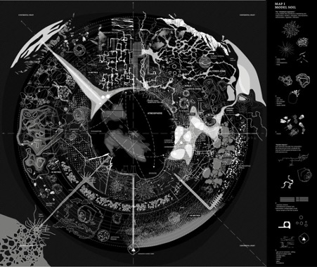
Map of the soil at multiple depths composed by an assemblage of organisms native to the soil and hosted objects mostly human-made. Credit: Frédérique Aït-Touati, Alexandra Arènes & Axelle Grégoire
Rather than being viewed from the outside, as is the case with the planetary view, such a framework should provide a view from within that gives a much better sense of what is necessary for each life form to survive. This means they argue for a change of perspective, not to look at standard block diagrams from nowhere, but from within. In this sense it is an exercise in cosmography, that is, how artistic imagination can serve to support new scientific concepts. Arranging objects in layers and relying on a “zoom” to get from one scale to the next, such a visualization cannot represent the internal feedback and the dynamic interfaces of processes in the critical zone since they vary enormously in scale and in time such as CO2 in the atmosphere, forests or industrial companies. Everything is moving and transforming no matter which element you look at, offering a dynamic vision that would be very difficult to express with a cartographic representation of objects. Meanwhile, in 2022, Arènes and her co-authors Frédérique Aït-Touati and Axelle Grégoire published the English translation of Terra Forma (2019) which contains a collection of their new “living maps”, a shift beyond “the space of grid-based maps” (Latour). Their navigation system is a Gaia Positioning System instead of GPS, as Jussi Parikka put it in his review of the book.[8]
Returning to the Eameses’ method at their time, as film scholar Eric Schuldenfrei elaborated, in a lecture at Harvard, Charles Eames demonstrated his concern with ecological issues. They used iconic photographs taken by NASA and repositioned them in support of an emerging environmental movement, demonstrating the extreme isolation and vulnerability of Earth floating in space.
GL: Over the past decades in Germany there has been an attempt to establish a new discipline called ‘image sciences’ (Bildwissenschaften). This is not so much a hardcore ‘science’ field (as the title suggests) but a branch of the arts and humanities with an emphasis on theory and art history. Due to federal funding politics, this new discipline has not really established itself yet, am I right? To me, it always looked like a local mix of visual culture, STS and art history. Do you mind if I position your work in this field? What are the main fields of research in this context and who are the key theorists in Germany, the largest European country where 85 million people both produce and consume tons of images? Why was it necessary to establish a new field, next to film studies, television and new media?
VT: The arts and the humanities are now also challenged by AI image generation, especially art history, media studies and cultural studies. The reflection of visual culture plays a role in several disciplines. The subject of ‘image science’ seems too narrowly defined mainly within the field of art history. The changes in visual culture brought on by smartphones, AI and social media are reflected in various disciplines, as artist Hito Steyerl, media theorist Simon Rothöhler, theorist of digital photography Estelle Blaschke and arts and media theorists Marietta Kesting or Shane Denson show in their recent writing, just to name a few. Alexander Galloway stated the shift of power from the image to the data level and Jussi Parikka from the visual to the ‘invisual’ and a focus on chains of operations. Making images operational means above all: building logistic chains of operations, pipelines in which images can become data–and turn invisible.
I see myself as a cultural scientist whose writing is transdisciplinary. I feel at home in cultural studies, as well as at the art academy with its focus on artistic practice. The Routledge Visual Culture Reader edited by Nicholas Mirzoeff was decisive for me during my studies. Since then, the field has been reorganised. Data, algorithms and AI play a more important role. A small book series on digital image cultures edited by Annekathrin Kohout and Wolfgang Ulrich holds up the field of “image science” on a small scale. Also, the federal DFG-funded priority programme The Digital Image is even closer connected to ‘Bildwissenschaften’ and German art history’s steps into digital culture.
Ultimately, the approach you have been pioneering and are pursuing at the Institute for Network Cultures fits partly in here but looks into networked images from a political point of view in global networked cultures, i.e. the impact of memes or glitches where they are politically relevant. Also think of Simon Strick who focused on social media activities of the far right. Limor Shifman was the first scholar to systematically approach and establish meme studies. Paul Frosh was the first to conceptualize screenshots. Nathan Jurgenson proposed the “social photo” and looked into social media practices. In regards to AI, Kate Crawford looked into the implications of ground-truthing in machine learning, Graham Meikle focused on deep fakes and Joanna Zylinska on art and AI.
GL: You finished this study in the spring of 2020 and had to defend your PhD in pandemic ‘social distancing’ circumstances in September 2020. What has happened to the field since then? My suggestion would be drones. They are not playing a role in your book and I was a bit surprised about that. To me, drones symbolize another ‘democratization’ of the exclusive, expensive, military view on the ‘politics of viewing from above’. Drones are now a ’trash’ technology, produced by the thousands by countries such as Iran, Turkey but also Ukraine and play a crucial role in everyday warfare on the frontline. They are also used by Russia to attack civilians. And by Ukraine in its attacks on the Kremlin, office high rises in Moscow and strategic infrastructure such as the Krim bridge. There are Telegram channels where both sides publish their daily short videos, recorded by the drone themselves, just before and during the attacks, often with striking details of their targets, such as running soldiers. Talking about scale…
VT: Drone attacks are playing an important role in the war in Ukraine. I have seen some of the videos that were uploaded to Twitter, the footage is in colour and in high resolution. They sometimes show soldiers in ‘unguarded’ moments or even surrender to a drone. I am only concerned with images (from drones, among other things), not with drones as weapons. The ones Ukraine uses in the attacks on Moscow, for example, do not leave behind any publicly accessible drone images – they are kamikaze drones. In April 2022, satellite images from the company Maxar caused an uproar among observers because they showed alleged mass graves on the outskirts of Mariupol – and thus allowed conclusions to be drawn about the conditions in the city, which was still under siege at the time.
In early 2023, Palantir CEO Alex Karp claimed that the Meta-Constellation software was responsible for most of the target detection and selection in Ukraine. His company has since been aggressively promoting Skykit, a kind of suitcase computer including a quadcopter drone and satellite dish that is said to be able to operate for days without being connected to the power grid. In The Good Drone. How Social Movements Democratize Surveillance (2020), sociologist Austin Choi-Fitzpatrick examines how commercial drones, satellites, kites and balloons are used by social movements for the common good. Instead of wars and state surveillance scenarios, the author is interested in new ways of application for civil interests.
GL: Do we need more planetary visions, new frontiers, more cosmo-technics, stacks and terra-forming projects? All these ideas and visual solutions, in the end, benefit the big elephant in the room: Google. Do we need more evidence in the first place and what role are artists playing in all this? In your book, you’re discussing the works of, for instance, Srah Sze, Judith Hopf, Matt Mullican, Hito Steyerl and Geocinema. What recent works have you seen that inspired you? Do we need more evidence a la Forensic Architecture or rather more questioning of the tools used in these evidence-gathering exercises?
VT: Artists can draw attention to ways of seeing and conventions of visualizing technologies. In order to link my analysis to aesthetics and visuality, I referred to artworks by Hito Steyerl, Matt Mullican, Judith Hopf, Sarah Sze and Geocinema and discussed the fact that artists’ pictorial spaces cannot always be clearly separated from instrumental images (a term introduced by Alan Sekula when he was writing about Edward Steichen’s aerial images that were shot during World War I and used as an instrument of remote sensing, while later on turning into aesthetic objects when included in the collection of the Museum of Modern Art in New York), as visual culture has been significantly influenced by the circulation of networked images in recent years. My methodology is to interrogate art from the perspective of cultural studies as a discursive source and to conceptualize images as objects of knowledge.
As you are suggesting, Geert, the availability of digital images and metadata online caused a paradigm shift from critique to a new practice, which Eyal Weizman called the “forensic turn”.[9] At the same time, it is worthwhile interrogating the tools employed and the visual language developed by Forensic Architecture in collaborative research projects and questioning how far conventional aesthetics of objectivity are being reproduced. As a member of Forensic Architecture, Godofredo Pereira documented the effects of state and corporate violence on territories and communities in the Atacama Desert—the embodied effects of mining. Partly the visuals coming from his research support the disruption of relations between bodies and territories, establishing inhuman categories. The extractive logic of remote sensing practices in copper mining and architectural research is notorious for keeping people out of the picture for a variety of reasons, including limited data resolution and sensors that collect data in narrowly defined wavelengths, leaving much organic matter invisible.
For example, three works that have recently given me food for thought are “Planet City” (2020) by Liam Young, “Asunder” (2019) by Tega Brain and Julian Oliver, and “As Birds Flying” (2016) by Heba Y. Amin. “Planet City” is a speculative, visually exuberant and reassuring response to the limits of growth and climate change in the 21st century. Young, like Charles Eames, is a Los Angeles-based architect who invests his modelling skills in the aesthetics of commercial film (responding to a neoliberal demand for professional visibility.) Like Eames, he captivates viewers by visualizing an optimistic outlook on a future in which cities integrate renewable energy without falling into the smart city trap, and humans retreat from resource extraction. The question here is whether Young is presenting a techno-optimist vision of urban density based on ecosystem services, or whether he convincingly represents post-colonial ideas of coexistence. Young’s project is a contemporary cosmogram in the sense that the literary scholar Jörg Dünne has built on Tresch and Latour. Following Dünne, he suggests that in the Anthropocene cosmograms no longer emerge from an imaginary view from above, but in the critical zone of the Earth’s atmosphere.
The work of Tega Brain and Julian Oliver, together with Bengt Sjölén, also takes a critical look at how computational technology and AI are shaping ecological thinking and knowledge. “Asunder” is a program with an artificial intelligence as an environmental manager that generates, recommends and models future changes to the planet in order to supposedly save its future. The neural networks are fed with a torrent of multi-perspective data, including solutions that seem more akin to world-building in computer games, where a player designs an ideal or idiosyncratic world from God’s point of view or the ‘Apollonian gaze’; in the case of AI and its application in the climate crisis, the process removes a critical human perspective, which is re-introduced in the art installation and in Tega Brain’s article “The Environment is not a System”.[10]
As part of her complex and meticulously researched work “The General’s Stork” Heba Y. Amin made a short film entitled “As Birds Flying” (2016). The work is based on a true story: Egyptian authorities captured a migratory stork in 2013, two years after the Egyptian Revolution in 2011, suspecting the bird of being a spy. The stork was fitted with a tracking device. Later it turned out that Hungarian researchers wanted to explore the migration route of storks. In her short film, Amin stages a poetic and humorous dialogue between the storks using found footage of drones, ironically mocking the anthropomorphisation of the animal, evoking a local cultural history of bird prophecy and questioning the politics of aerial surveillance in general and Western military reconnaissance in particular.
Amin’s research-based artistic practice critically engages with aerial modes and epistemic methods related to drone vision: knowing that the technology can have an impact on the real world, such as humans on the ground in Egypt developing a “psychopathological relationship to airspace”[11], she metaphorically refers to the fact that the means of extracting information have developed over the course of time. At the beginning of the 20th century, a geeky pharmacist named Julius Neubronner based near Frankfurt had the idea of an animal-camera assemblage, attaching a miniature camera with a timing mechanism to a pigeon. His initial intention was to ‘track’ the flight path and whereabouts of his pigeons. The few archived images affect human sensory perception for their immersive optics as well as the surveillance instinct which Neubronner expressed in his patent title “Method and apparatus for photographing sections of terrain from a bird’s eye-view”.
—
[1] Christine Buci-Glucksmann, Der kartographische Blick der Kunst, aus dem Französischen von Andreas Hiepko. Berlin: Merve 1997.
[2] Jussi Parikka, Operational Images. From the Visual to the Invisual, Durham: University of Minnesota Press 2023.
[3] https://www.thenewatlantis.com/publications/the-conquest-of-space-and-the-stature-of-man
[4] Bernard Geoghegan, “The Geo-Scopic Drive. Planetary Forensics and Computer Graphics”, 2 September 2023, University of Massachusetts Amherst, online lecture.
[5] Kepes, Gyorgy. “Introduction to the Issue ‘The Visual Arts Today.’” Daedalus 89, no. 1 (1960): 3–12. http://www.jstor.org/stable/20026543
[6] Kepes, Gyorgy. “Toward Civic Art.” Leonardo 4, no. 1 (1971): 69–73. https://doi.org/10.2307/1572235
[7] James Vincent, “Microsoft’s AR glasses aren’t cutting it with US soldiers, says leaked report”, The Verge, October 2022, https://www.theverge.com/2022/10/13/23402195/microsoft-us-army-hololens-ar-goggles-internal-reports-failings-nausea-headaches.
[8] https://muse.jhu.edu/article/880536/pdf
[9] Eyal Weizman, „Introduction: Forensis“. In: Forensic Architecture (eds.), Forensis. The Architecture of Public Truth, Berlin: Sternberg Press 2014, p. 10.
[10] Brain, Tega. The Environment is not a System. APRJA Volume 7, Issue 1, 2018, pp. 153-165. https://aprja.net//article/view/116062/164244
[11] Anthony Downey in his introduction to an interview with Heba Y. Amin. Amin, Heby.Y., Downey, Anthony. Contesting post-digital futures: drone warfare and the geopolitics of aerial surveillance in the Middle East. Digi War 1, 65–73 (2020). https://doi.org/10.1057/s42984-020-00021-y